Back to all Use Cases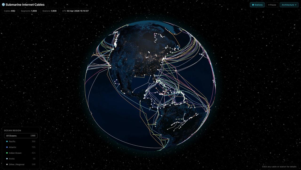 Talk to us →
UC19Telecom / NTN
🌊 Submarine Internet Cables
The hidden backbone of the internet mapped in 3D. TeleGeography's authoritative cable GeoJSON is fetched, segmented, and rendered as geodesic paths on a globe.gl WebGL globe using the cable operator's own colour palette. Toggle cable landing station dots, filter by ocean region, and click any cable or station for metadata and ownership details.
Demo Pages
What you'll see
- ✓500+ active submarine cables from TeleGeography's public GeoJSON
- ✓Geodesic path rendering via globe.gl pathsData — no Three.js needed
- ✓Ocean region filter: Pacific · Atlantic · Indian · Arctic · Other
- ✓Toggle cable landing stations as dot overlay
- ✓Click cable for name, RFS year, length, owners, landing countries
- ✓24-hour edge cache — cable data rarely changes
Tags
Submarine CablesInternet InfrastructureTeleGeographyGeoJSONWebGL
Want this for your data?
We can build a custom version of this use case for your stack.