Back to all Use Cases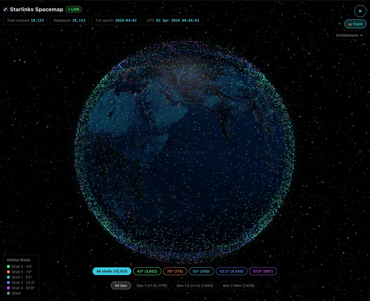 Talk to us →
UC15Telecom / NTN
🛰️ Starlinks Spacemap
The complete Starlink mega-constellation tracked in real time. Live Two-Line Element (TLE) data from CelesTrak feeds satellite.js SGP4 propagation, computing geodetic positions for every active Starlink satellite every 5 seconds. Rendered on a globe.gl WebGL globe with NASA Earth-Night texture, orbital shell color coding, generation filters, and 90-minute animated ground tracks.
Demo Pages
What you'll see
- ✓6,000+ Starlink satellites tracked in real time via CelesTrak TLE feed
- ✓SGP4/SDP4 orbital propagation using satellite.js — positions updated every 5 s
- ✓5 orbital shells color-coded: 53°, 53.2°, 70°, 97.6°, 43° inclination
- ✓Click any satellite for altitude, velocity, inclination, and orbital period
- ✓90-minute animated ground track with dashed orbital path
- ✓Generation filter: Gen 1 (v1.0), Gen 1.5, Gen 2 Mini
- ✓globe.gl WebGL rendering — NASA Earth Night texture, topology bump map
Tags
StarlinkSatellitesTLESGP4OrbitalReal-timeWebGLSpaceX
Want this for your data?
We can build a custom version of this use case for your stack.